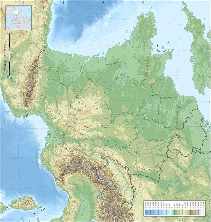
Categoría: Imagen Mapas > topografía de Francia
Dibujos para colorear, colorear imágenes, educación, escolar, dibujos, colorear la imagen: topografía de Francia
Palabras clave: topografía de Francia, topografía de francia, francia,
Image information
Attribution and Share-Alike required
Any use of this map can be made as long as you credit me (Eric Gaba – Wikimedia Commons user: Sting) as the author and distribute the copies and derivative works under the same license(s) that the one(s) stated below. A message with a reply address would also be greatly appreciated.
Sources of data:
Blank topographic map of France in the official Lambert-93 projection, with regions boundaries.