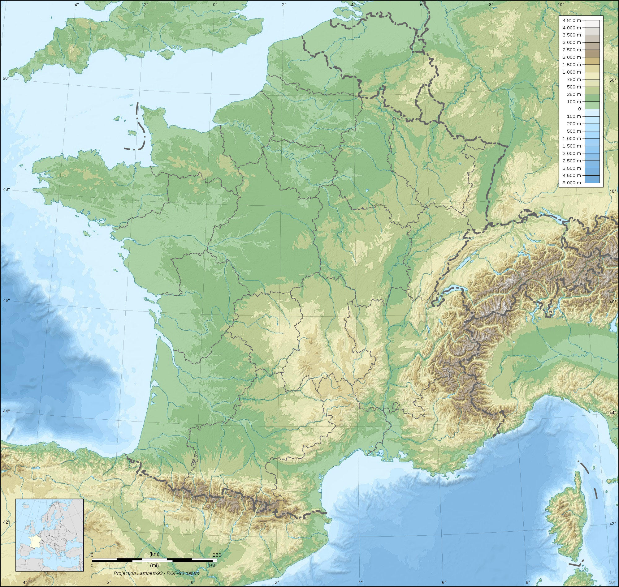
Imagen topografía de Francia

Imagen topografía de Francia
Clipart de Francia topográfico con diferencias de elevación en verde y marrón y cuerpos de agua visibles. Gratis para descargar e imprimir.
Categoría: Imagen Mapas > topografía de Francia
Palabras clave: topografÃa de Francia, topografÃa de francia, francia, topografia de francia
Image information
Attribution and Share-Alike required
Any use of this map can be made as long as you credit me (Eric Gaba – Wikimedia Commons user: Sting) as the author and distribute the copies and derivative works under the same license(s) that the one(s) stated below. A message with a reply address would also be greatly appreciated.
Sources of data:
- Topography: NASA SRTM30 (public domain);
- Bathymetry: NGDC ETOPO1 (public domain);
- Additional data: NGDC World Data Bank II (public domain).
Blank topographic map of France in the official Lambert-93 projection, with regions boundaries.
Todas las imágenes pueden utilizarse para fines educativos privados y no comerciales.
Para cualquier otro uso, consulte la Licencia de la imagen y/o los Términos de uso.
Si desea más información, no dude en contactarnos.